Pleasanton's Eagle Ford Shale Location Primes it for Growth

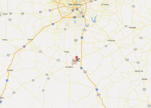
Pleasanton TX Map
Pleasanton TX Map

Pleasanton is located near the heart of the Eagle Ford Shale in Atascosa County, just 35 miles south of San Antonio. The city's location provides a strategic hub for many oil & gas companies working the play. Jennifer Hiller published an article over the weekend highlighting development in the area. You can read the full article at mysanantonio.com.

Highlights from the article include:

  • The population sign says 8,622, but utility hookups indicate the population is 11,500+
  • Rentals have gone from $0.60-0.70 per sq ft/month to as high as $1.50 per sq ft/month
  • The city enacted a 180-day moratorium on new RV parks
  • Sales tax revenues were less than $2.1 million in 2010 and have already surpassed $3.5 million this year

Eagle Ford Shale Regional Rig Count at 271 on August 10, 2012

Chesapeake Eagle Ford Rig Map

The Eagle Ford Shale drilling rig count grew to 271 this past week. News this week built on what we heard last week when several operators discussed drilling efficiencies and dropping rigs in response. Chesapeake highlighted its success in lowering well costs by 15% through drilling time improvements and other oilfield service costs. The company also plans to drop from almost 33 rigs running in the first half of the year to 25 at year-end and 22 for 2013. The company is also working off a backlog of 220 wells that have been drilled, but have not been brought to production.

Read our coverage of Chesapeake's quarterly release in the article Chesapeake Will Run 22 Eagle Ford Rigs in 2013.

Eagle Ford Oil & Gas Rigs

The number of natural gas rigs (Smithbits) stands at 59 this week, up one from last week. For the eighth week running, the only counties with over ten rigs targeting natural gas are Karnes and Webb. There are 210 oil rigs working, which ties the record set in April 27th.

Henry Hub futures were trading at ~$2.78 on Friday afternoon. That's a drop of almost 10% over the past three weeks. Notably, spot prices (physical prices today) are off, but still closer to $3 at $2.96 per mmbtu.

WTI was trading at ~$93/bbl Friday afternoon and LLS crude prices are just above $110/bbl. As I've mentioned several times before, if prices continue to rise we'll likely see additional drilling capital committed to the area.

There are 247 horizontal rigs running in the region. The three counties leading development are Karnes with 36 rigs, McMullen with 32 and La Salle with 31. Dimmit (29), Webb (20), DeWitt (19), Gonzales (17), Atascosa (12), Live Oak (11), and Frio (10) round out the top Eagle Ford counties.

News items this week included:

Come back weekly for updates or sign up for alerts.

Drilling Rig Count by Operator

What is the Rig Count?

The Eagle Ford Shale Rig Count is an index of the total number of oil & gas drilling rigs running across a 30 county area in South Texas. The South Texas rigs referred to in this article are for ALL drilling reported by SmithBits and not solely wells targeting the Eagle Ford formation. All land rigs and onshore rig data shown here are based upon industry estimates provided by the Baker Hughes Rig Count and/or Smith Service Co's (Schlumberger) Smith Rig Count.

Drilling Rigs by County

Magnum Hunter Adds Pearsall & Eagle Ford Acreage in Atascosa County

Magnum Hunter Atascosa Pearsall Acreage

Magnum Hunter Resources added 1,885 net acres to its holdings in Atascosa County for approximately $2.35 million. The company now has over 7,000 gross (5,000 net) acres in the area with potential for 40 net Pearsall Shale locations.

The Company's Atascosa core area appears to have an ideal geologic setting for the Pearsall development. Management believes the area to be located within the "wet gas to rich condensate window." The area is bound by the Charlotte fault trend eight miles to the north and the Karnes fault trend to the south. The Pearsall Shale is located about 2500' beneath the Eagle Ford Shale and is approximately 500-600' in thickness. Composed of interbedded organic shale, silica and limestone, the Pearsall Shale is similar in composition to the Eagle Ford Shale.


Rosetta Resources Plans Eagle Ford Development at 55-Acre Spacing at Gates Ranch

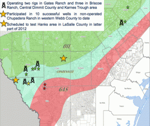
Rosetta Eagle Ford Map | June 2012

Rosetta Resources continues to evaluate its well spacing tests across the Eagle Ford, but results to date show no interference from wells tested at 425-565 ft apart or 50-65 acre spacing. Without signs of interference, the company is going forward with development at 55-acres spacing. The lower down-spacing interval will allow the company to drill 428 wells across its Gates Ranch properties; a 29% increase.

Rosetta expects it had approximately 800 net wells to be completed throughout its Eagle Ford position at the end of 2011. Over 30% of those are located in the Gates Ranch area of Webb County where the company has two rigs running continually. The company's rigs are spread throughout the Briscoe Ranch, Central Dimmit County and the company's Karnes County acreage.


Chesapeake Will Run 22 Eagle Ford Rigs in 2013 - 220 Well Backlog

Chesapeake Eagle Ford Rig Map

Chesapeake Energy announced impressive results from their Eagle Ford operations again. The company's production stretched to more than 36,000 boe/d net, while gross operated production averaged more than 75,000 boe/d. Approximately two-thirds of production is oil, while the rest is split evenly between natural gas liquids and natural gas. The story should just get better as new gathering and midstream infrastructure expected in the fourth quarter of the year will improve price realizations by almost $5/bbl.

Like Marathon and EOG last week, the company is hitting its stride in terms of development and reported costs savings of 15% per well attributable to drilling efficiencies and service costs savings.

Chesapeake now has 337 wells producing, with a whopping inventory of 220 wells that have been drilled, but are not yet producing. It's safe to say their completion and gathering crews have their work cut out for them, but they should be able to catch up. The company announced plans to lower its operated rig count to 25 by year-end, with plans to operate 22 rigs in 2013. That's after averaging almost 33 rigs in the first half of 2012.

Of the 121 wells the company brought on in the second quarter, 110 had initial production rates in excess of 500 boe/d and 37 of those produced more than 1,000 boe/d. Three wells highlighted by the company include:

  • Gates 010-CHK-B TR1-D6H in Webb County, TX, with a peak rate of approximately 2,070 boe per day, consisting of 710 bbls of oil, 665 bbls of NGL and 4.2 mmcf of natural gas per day
  • Holubar Dim C 2H in Dimmit County, TX, with a peak rate of approximately 1,900 boe per day, consisting of 1,730 bbls of oil, 110 bbls of NGL and 0.4 mmcf of natural gas per day
  • Foley MCM A 1H in McMullen County, TX, with a peak rate of approximately 1,500 boe per day, consisting of 1,335 bbls of oil, 55 bbls of NGL and 0.6 mmcf of natural gas per day.

Read more from the company's quarterly release at www.chk.com